High pressure remains in charge over the next few days, meaning we see a continuation of the current chilly, but settled conditions.
A chilly start on Monday morning, with some frost and fog in places
Most of us will be dry, though still a lot of cloud around ☁️ pic.twitter.com/flxaGgFo0a
— Met Office (@metoffice) December 28, 2025
There will be clear skies for many areas tonight, allowing temperatures to fall away and resulting in a widespread frost in the north.
Tomorrow (Tuesday) will be mostly dry with patchy cloud and sunny spells, though there may be a few showers in eastern coastal counties. Later, cloud will thicken in northern Scotland, with patchy rain and strengthening winds.
Things look largely settled for many on New Year’s Eve, but turning windy with showers in Scotland. Conditions then turn colder at the turn of the year.
Turning colder into the New Year
Throughout Thursday, showers will increasingly turn to snow in northern Scotland, and a strong, perhaps gale force northerly wind will also set in. A yellow national severe weather warning for snow and ice has been issued, with some significant accumulations possible by Friday morning.
⚠️ Yellow weather warning issued ⚠️
Snow and ice across northern parts of Scotland
Thursday 0600 – 2359 Friday
Latest info 👉 https://t.co/QwDLMfRBfs
Stay #WeatherAware⚠️ pic.twitter.com/HocKCRlClB
— Met Office (@metoffice) December 29, 2025
Met Office Deputy Chief Forecaster Mark Sidaway said: “It certainly looks like we are in for a taste of ‘winter’ as we welcome in the New Year, initially in the north, but more widely across the UK for the first week of 2026.
“Arctic air and strong northerly winds will bring cold or very cold conditions to all parts of the UK, and it will feel especially cold in the strong winds. Widespread and locally severe frosts are expected, along with the first snow of the winter for many.
“A yellow warning for snow and ice has been issued for northern Scotland on New Year’s Day and beyond, where frequent and heavy snow showers may lead to some travel disruption.
“These colder conditions and wintry hazards – snow, ice and strong winds – will develop more widely as we enter the New Year, with more warnings for snow and ice likely. It looks like this cold spell will last through at least the first week of January, so it’s important people keep up to date with the latest forecast and warnings.”
Staying safe in colder temperatures
The UK Health Security Agency (UKHSA) has issued an amber cold health alert for the health sector covering the North East and North West of England until January 5. All other regions in England will be under a yellow alert for this period.
Dr Agostinho Sousa, Head of Extreme Events and Health Protection at UKHSA, said: “As the colder weather sets in it is vital to check in on friends, family and neighbours that are most vulnerable.
“The forecasted temperatures can have a serious impact on the health of some people, leading to increased risk of heart attacks, strokes and chest infections, particularly for individuals over the age of 65 and those with pre-existing health conditions.”
With freezing temperatures and the potential for snow and ice, the Met Office’s WeatherReady campaign offers practical advice to help you prepare your home, garden, and daily routines for winter weather.
Read: 5 tips for staying safe in snow
Read: 4 tips for staying safe in ice
Read: Keeping your home warm this winter
Read: How cold weather affects your health
Read: What to do if you have a frozen or burst pipe
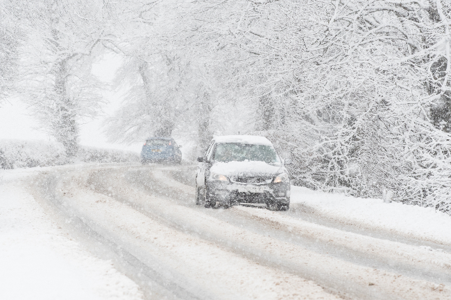
How far ahead can snow be forecast in the UK?
In many temperate countries such as the UK, a small amount of snow can cause all sorts of disruption. But it can also be very challenging to predict. There are lots of factors involved in determining whether rain or snow will be falling from the sky, such as elevation, distance from the coast and precipitation intensity as explained in this animation.
Read: The year in weather: 2025
Keep up to date with the latest forecast for your area using our forecast pages. You can also follow us on Twitter and Facebook. Use our mobile app which is available for iPhone from the App store and for Android from the Google Play store.
Met Office